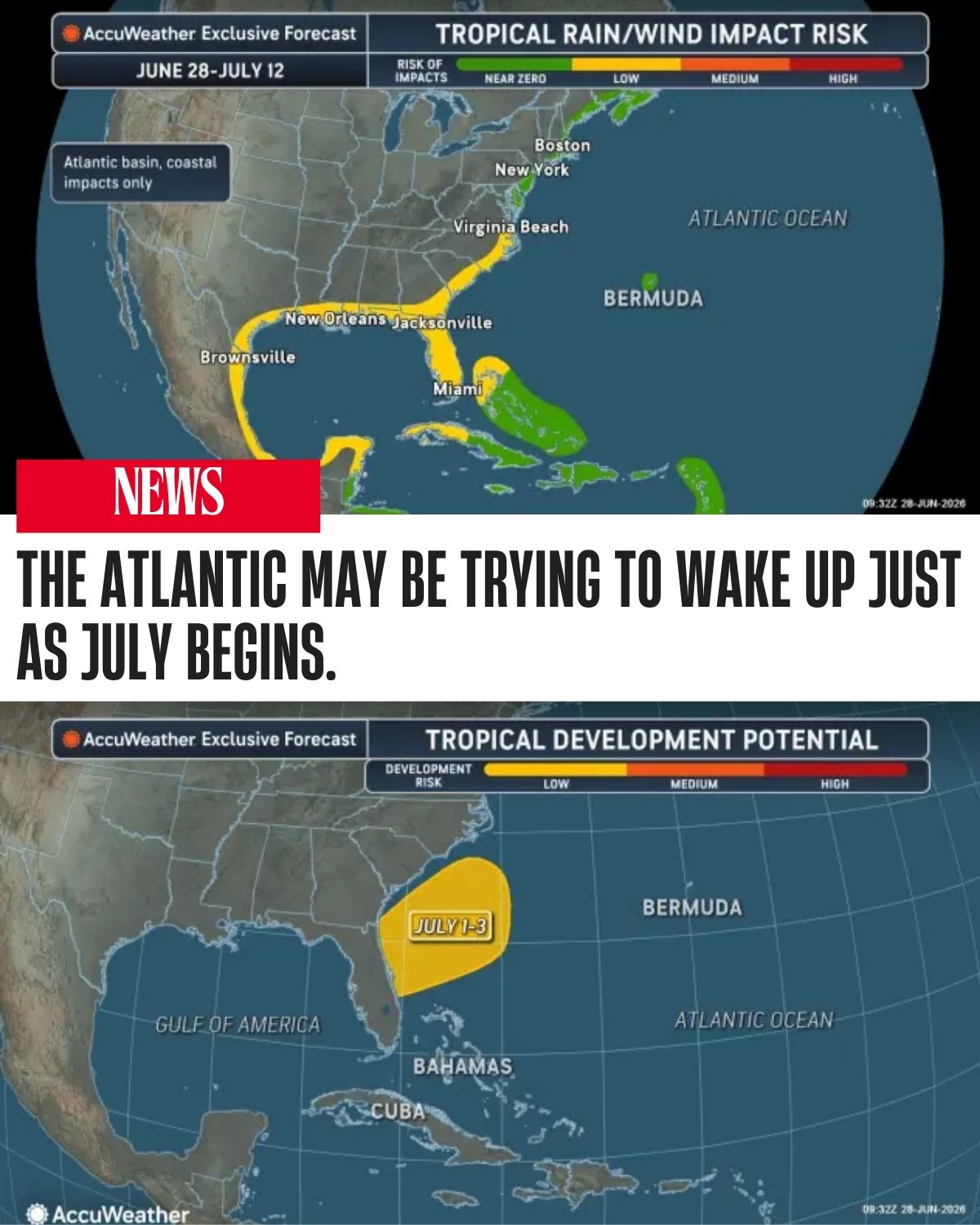
AccuWeather meteorologists are monitoring the southwestern Atlantic for possible tropical development during the first week of July, as warm ocean waters and a shifting summer weather pattern create a window for storm organization near the southeastern United States.
The next name on the Atlantic tropical storm list for the 2026 hurricane season is Bertha.
Forecasters say clusters of thunderstorms are expected to develop near the tail end of a front that stalls close to the southern Atlantic coast later this week. If those storms consolidate into a low-pressure area over warm waters, they could gradually strengthen into a tropical or subtropical system.

Warm Atlantic Waters Could Fuel Storm Development
The potential development zone will be near the coast of the Carolinas, Georgia and northern Florida, where warm Atlantic waters can support clusters of thunderstorms.
If a low-pressure area forms and remains over water long enough, it could become more organized. However, AccuWeather meteorologists say the system’s development chances may be limited if it moves ashore too quickly.
Any tropical system or loosely organized storm cluster that moves into Georgia or northern Florida would likely struggle to strengthen further over land.
Heat Dome Pattern May Help Steer Storm Clusters
The possible tropical development comes as a large heat dome builds over the Midwest. This heat dome will create a clockwise flow around an area of high pressure, guiding clusters of thunderstorms along its edges.
Storms are expected to move northeastward from the Rockies into the Dakotas, eastern Montana and western Minnesota before turning southeastward near the Great Lakes.
Farther south, thunderstorm clusters may move in the opposite direction, drifting from east to west across parts of the Southeast. That unusual movement could push storms from the southern Atlantic coast into Georgia, Florida, Louisiana and Texas.

Development Chances Remain Uncertain
Multiple storm clusters may follow this westward track during the week. However, their chances of becoming organized tropical systems could be limited by their proximity to land and strong northeasterly wind shear.
Wind shear can disrupt tropical development by tilting or weakening thunderstorms before they can form a more organized circulation.
Even if no tropical depression or tropical storm forms, the pattern is still expected to bring rounds of heavy rain and gusty thunderstorms from the Carolinas through Georgia and Florida, then westward toward Louisiana and Texas.
At the same time, areas farther north will remain under the influence of the heat dome, with dangerous heat and humidity continuing across parts of the Midwest and East.
Beachgoers and Boaters Should Stay Alert
Swimmers and boaters along the Southeast coast should monitor local forecasts closely this week.
Even if skies appear dry at times, the unsettled pattern could increase the risk of locally rough surf, choppy seas, dangerous lightning and rip currents. Rip currents can become dangerous even when tropical development does not occur.
Thunderstorms moving near beaches and coastal waters may also create sudden changes in wind and wave conditions.

Pattern Resembles Tropical Wave Movement
Forecasters say the setup resembles the westward movement of tropical waves that usually travel from Africa across the tropical Atlantic toward the Caribbean during the peak of hurricane season.
While this system would form much closer to the United States, the westward storm motion is similar to the broader pattern often seen later in the season.
For now, the main threats appear to be heavy rain, gusty thunderstorms, rough surf and rip currents. But with warm waters in place and storm clusters expected to linger near the coast, AccuWeather meteorologists will continue watching for signs of tropical or subtropical development as July begins.