Washington State is a breathtaking landscape of mountains, forests, and coastlines, but beneath its beauty lies a geological ticking time bomb. Experts warn that the region’s stunning features are shaped by powerful forces that could unleash catastrophic events at any moment, making it a geological nightmare waiting to happen.
 The potential for disaster is alarmingly high. In the event of a significant earthquake, certain areas of Washington, particularly Seattle and Tacoma, could experience a phenomenon known as liquefaction. This occurs when the ground loses its solidity, transforming into a liquid-like state. Roads could crack, buildings might tilt, and entire neighborhoods could become unstable in mere minutes.
While many fear the offshore Cascadia earthquake, the Seattle fault presents a more immediate danger lurking right beneath the city. This fault has a history of producing violent earthquakes that could trigger landslides and infrastructure damage, potentially sending tsunami waves racing through Puget Sound with little to no warning.
But the risks don’t stop there. Beneath the waters of Puget Sound, unstable sediments could collapse, leading to submarine landslides that displace massive amounts of water and create localized tsunamis. If the Cascadia subduction zone ruptures, the aftermath could leave coastal communities isolated for days, cut off from essential supplies and rescue efforts.

Volcanic eruptions pose another threat. The ash from an explosive eruption can darken the skies, disrupt air travel, and contaminate water sources. Washington’s glaciers, while picturesque, can also unleash devastating floods when ice dams fail or volcanic heat melts their frozen reservoirs.
The Cascades are notorious for their avalanche-prone terrain, where sudden weather changes can transform serene slopes into deadly walls of snow. Additionally, during intense wildfire seasons, thick smoke can envelop the state, creating hazardous air quality and apocalyptic scenes without a single flame in sight.

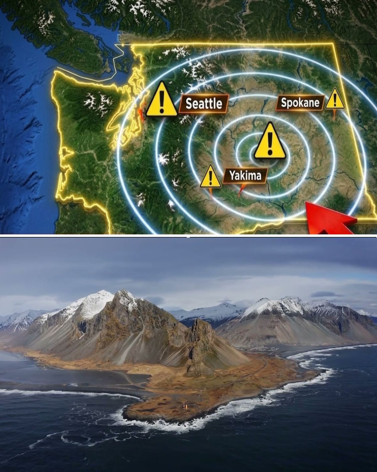
Washington’s reliance on major dams and river control systems adds another layer of risk. A significant earthquake or landslide could lead to cascading failures, unleashing destructive floods in populated valleys. The Cascadia subduction zone, known for its potential to produce a magnitude nine earthquake, is a constant reminder that the next major disaster is not a question of if, but rather when.
Mount Rainier, often viewed as a peaceful giant, is a heavily glaciated volcano that poses serious risks. Its potential to collapse could lead to lahars—fast-moving flows of volcanic debris that can devastate communities downstream. Similarly, Mount St. Helens, which dramatically reshaped the landscape in 1980, remains an active threat as it continues to rebuild itself from within.

The state is a complex tapestry of geological features, from the ancient petrified forests to the unique formations of the San Juan Islands, each telling a story of the earth’s violent past. The Pacific Ring of Fire, where earthquakes and volcanoes abound, serves as a stark reminder of the forces at play beneath the surface.
With so many potential hazards, one must wonder: is it the looming threat of earthquakes, the volcanoes that could erupt at any moment, or the remnants of catastrophic floods that make Washington so terrifying? What are your thoughts on the geological risks of the Evergreen State?
https://www.youtube.com/embed/z4X5rLzGNac